Highly-requested features: Bulk Edit, Bulk Copy, Hide Parcel Markers, and more
We pride ourselves on listening to your feedback and we have a number of feature improvements – large and small – based on customer feedback. Thank you to everyone who suggested these updates and we hope these will continue to help optimize your land siting process in Anderson Optimization.
Bulk Edit Parcel, Project, and Grid Details

Managing data efficiently is critical throughout siting a renewable energy project --- maybe you need to change the site control status, star rate, add a note, or fix a mailing address for hundreds of parcels on a campaign at once?
Now, you can easily edit asset details at scale through our new bulk edit functionality: edit metadata about selected parcels, projects, and grid infrastructure for selected records, in just a few clicks.
You can also filter and sort a list to bulk edit only a subset of records on a larger campaign.
Use the bulk edit tool to change project status, project technology, project stage to keep your list of projects organized and up-to-date.
Bulk copy/save features from a layer overlay to your map
Now, you can easily copy/save multiple features from a layer in one go.
Bulk copy features to the map from your selection area
Sort or filter objects before saving, if desired.
Export copied/saved drawings in the project KMZ export

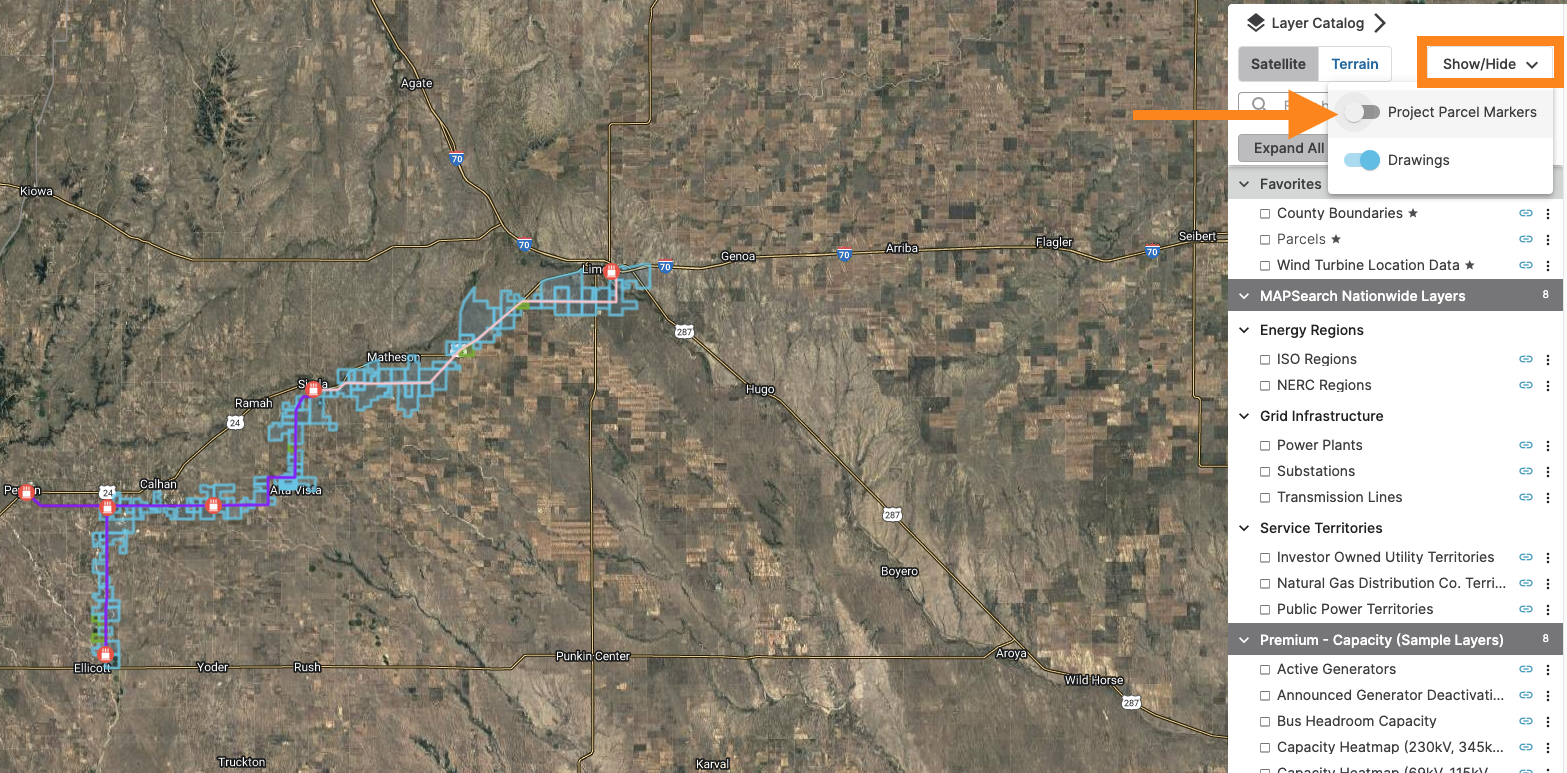
Hide/show parcel landowner labels and blue parcel markers
You can now adjust the visibility of the blue parcel markers and landowner labels on parcels via the new toggle under the layer catalog. When you change the setting, we’ll save your preference for the rest of your session/other projects in the same session.

Highlight location on map
Hover over any row in the datatable/tab view on a project to highlight the associated object/location on the map.

Tip: Did you know that you can also “Zoom To” an object on the map right from the datatable/asset tab? Just right-click on a row in the table and click the “Zoom To” button to zoom to the object’s extent on the map.
New imagery layer available in U.S. layer catalog
While we can’t control how frequently satellite and aerial imagery is updated in our basemap, our GIS team has recently integrated another source of imagery that you can overlay on the map for another look at the site.
Check out the new USDA NAIP Imagery layer in the U.S. layer catalog
USDA refreshes the imagery state-by-state about every two years during the "growing season".
As new imagery products come in from their contractors, USDA will update the layer.
Imagery is generally from 2021, 2022, or 2023 depending on the state.

Lat/long coordinates for any point on the map
Need to grab coordinates from a point on the map? Use the drawing tools to quickly find the latitude and longitude of any place on the map.


We’ve also made it easier to find the latitude and longitude for parcels, substations, and drawings by adding the coordinates to the header of the map pop ups.
PVcase KML Export
If you didn’t see the news, we recently joined forces with PVcase. As part of streamlining the end-to-end renewable siting process, we’ve worked with the PVcase team to make sure our KML exports are a breeze to import into PVcase for layout and design.
Don’t currently use PVcase? Reply to this email and we are happy to introduce you to the PVcase team for a demo and free trial.

Fixes & Updates
Portfolio View Enhancements:
As you add/remove columns or adjust the order of the columns in your view, we’ll remember those settings the next time you view the page.
Added the Map Tools button to the new view so you can measure distance and area directly on the map
More fields are now directly editable in the parcels table
Shapefile Import: Map now pans/zooms to the file location on the map when you import a shapefile
Fixed layer legend to reflect custom map styling
New Nationwide Layers
U.S.
Distressed and Disadvantaged Communities (USDA)
Energy Storage Projects (LBNL)
Microwave Beam Paths (FCC)
Military Training Routes (USGS)
National Pipeline Mapping System (PHMSA)
Note: Due to data provider’s terms of service, you can only view the layer. You cannot save data from the layer to the map and you cannot view the pipeline routes when zoomed in close to the map.
Public Schools (HIFLD)
PV Rooftop Database (NREL)
Zip Code Boundaries (Esri, TomTom)